
July & August 2026 Release v.3.21.0
INVISION v3.21.0 marks an exciting step forward in how trial data is shared, analyzed, and used in the field. This release launches CANTERRA’s new Performance Website, brings weather context into Insights, and makes everyday work across protocols, GIS Workstation, file processing, and mobile more reliable.
Highlights
CANTERRA Performance Website
CANTERRA’s new Performance Website is now live, turning trial data managed in INVISION into a polished public experience for growers, retailers, and customers. The site gives CANTERRA a central place to showcase performance results, share individual trial outcomes, and bring those results into broader customer outreach.
This launch establishes a new way for organizations to publish and share their trial results directly from INVISION.
Explore the CANTERRA Performance Website
Precipitation Analysis in Insights
Weather is now part of the story in Insights. Users can compare rainfall during a trial with the historical average for each field, identify drier or wetter conditions, define a custom range, and focus the analysis on a specific growth-stage window.
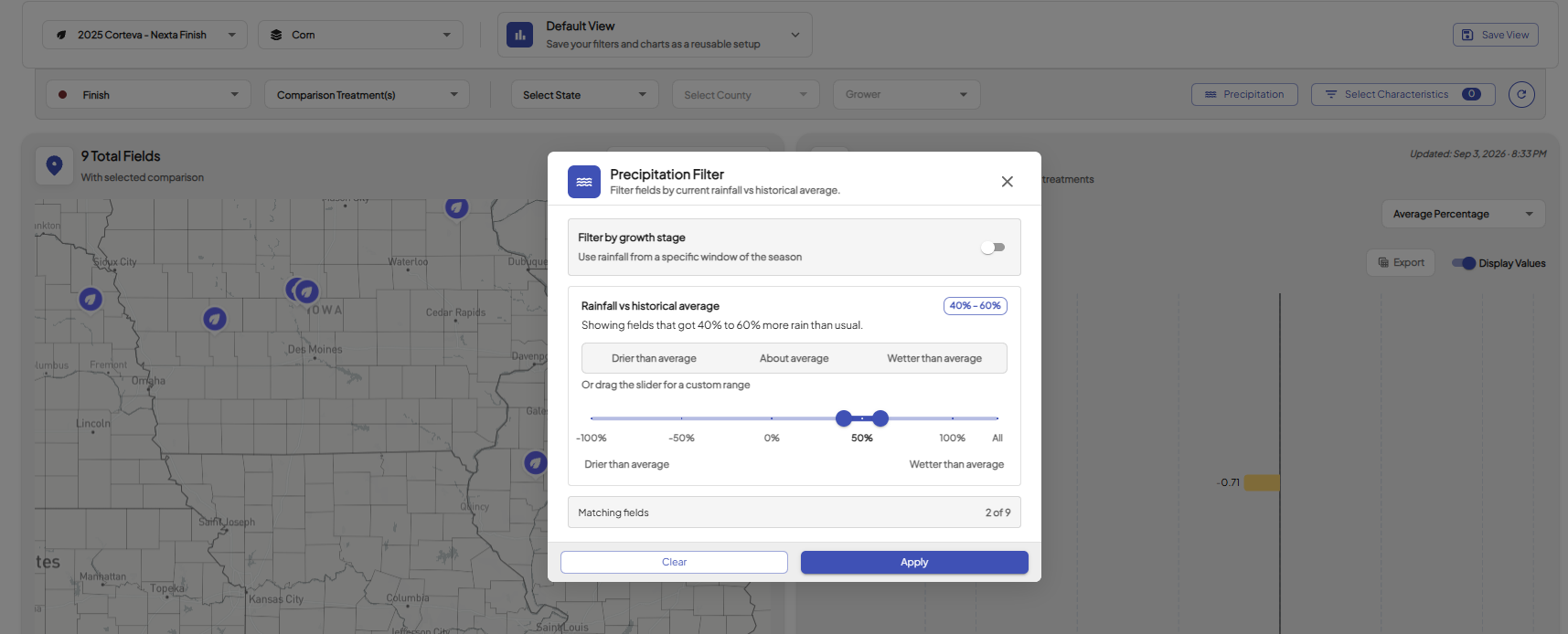
This gives users a clearer way to understand how treatments performed under different moisture conditions and adds important environmental context to trial results.
Feature Enhancements
-
Field Guide Workflow: Field Visit steps that do not require location data can now be completed from the desktop, making it easier to upload field-specific guides, track completion, and access guides from mobile.
-
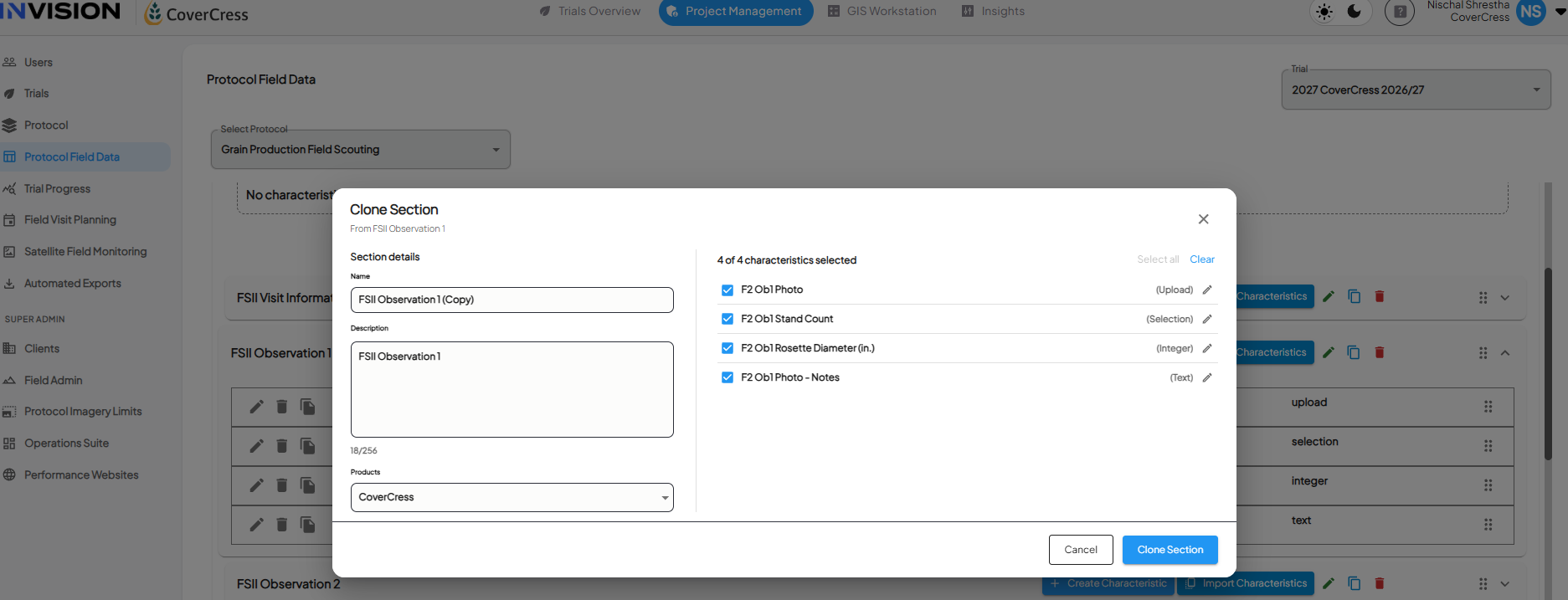
Clone Protocol Sections: Users can duplicate an existing protocol section and its characteristics, then adjust the copy instead of rebuilding it from scratch.
-
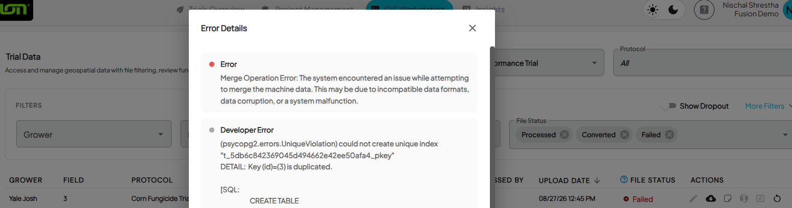
Clearer File-Processing Feedback: Users can select a file marked Failed to view its processing error directly in INVISION, making it easier to understand what happened and determine the next step.
-
Complete Layer Visibility: Converted files now display all product layers included in the source data, making complete machine-data records easier to review.
-
Adjustable Polygon Outlines: Users can reduce polygon outline thickness in GIS Workstation, improving visibility when files contain many small polygons.
-
Improved Mobile Data Export: Users can now save or share unsynced mobile data from iOS PWA or desktop for recovery and support purposes.
Bug Fixes
-
Optional Products for Sections: Sections can now be created before products are assigned.
-
Special Characters in Field Notes: Field Notes now support quotation marks and other special characters.
-
Field Visit Question Order: Fixed an issue where questions could become rearranged after being saved.
-
Trial Tracker Status Accuracy: Fixed incorrect upload statuses for fields associated with multiple protocols.
-
Empty Converted Files: GIS Workstation now provides a clear message when a converted file contains no usable machine-data records.
-
Operation Date Layer Controls: Fixed operation-date controls so layers show and hide correctly.
-
Product Categorization: Fixed an issue where not all products appeared when categorizing files by Product.
-
Trial Area Editing: Users can now delete Trial Area points and save their changes successfully.
-
Planner Mode Visit Loading: Fixed an issue where downloaded visits could temporarily display “0 out of 0 visits” in low-service conditions.
-
Offline Field Visit Recovery: Fixed an issue where saved offline visits could reopen with a blank form, making unsynced responses appear lost.