October 2024 Release v3.4.0
We’re excited to announce the launch of INVISION v3.4.0! This release introduces Elevation Maps and enhances usability and efficiency across multiple features.
New Features & Improvements
-
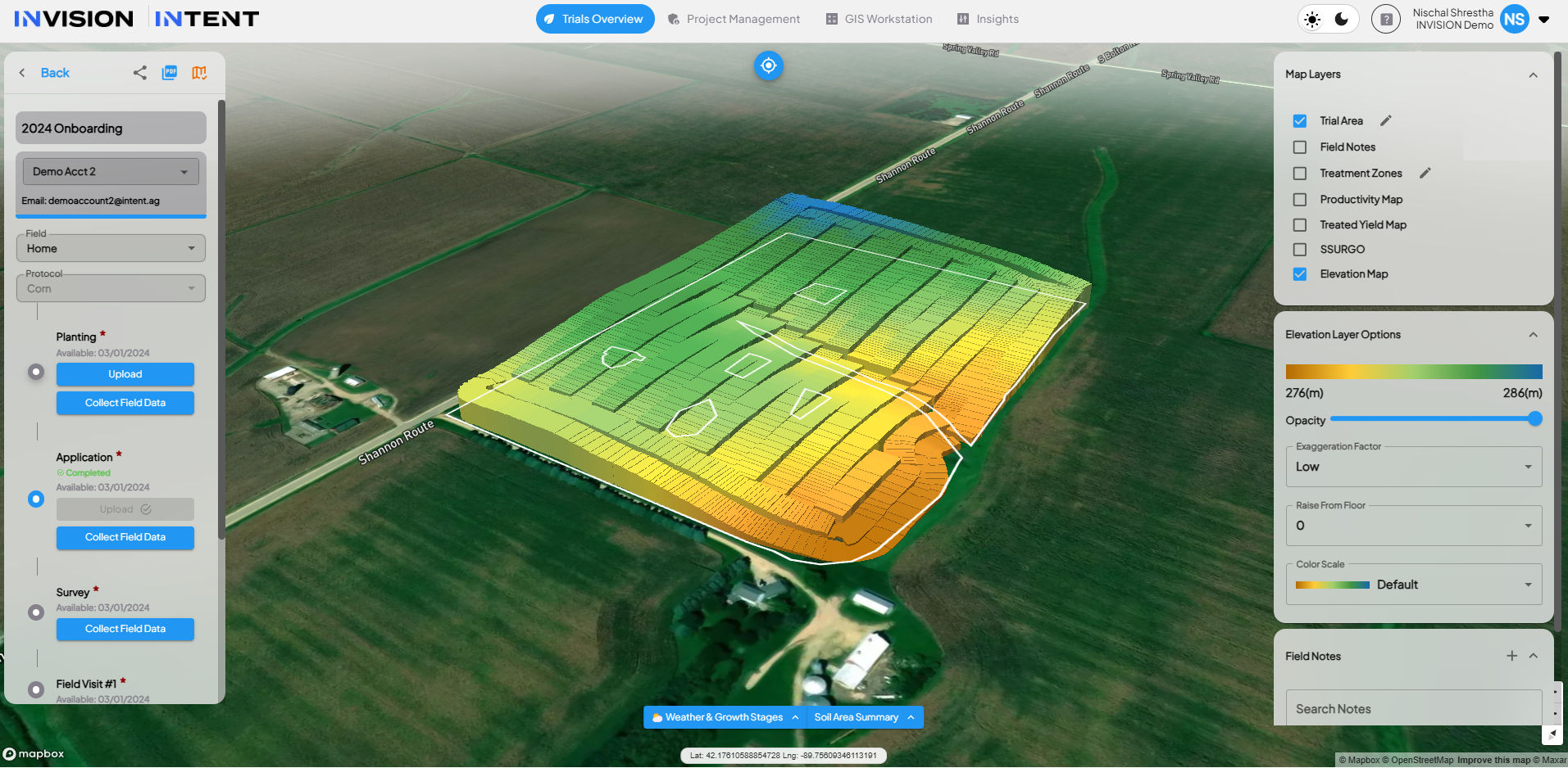
Elevation Maps in View Fields
-
INVISION now automatically generates elevation layers based on planting and as-applied data files, providing enhanced field-level insights.

-
-
Enrollment Upgrades

-
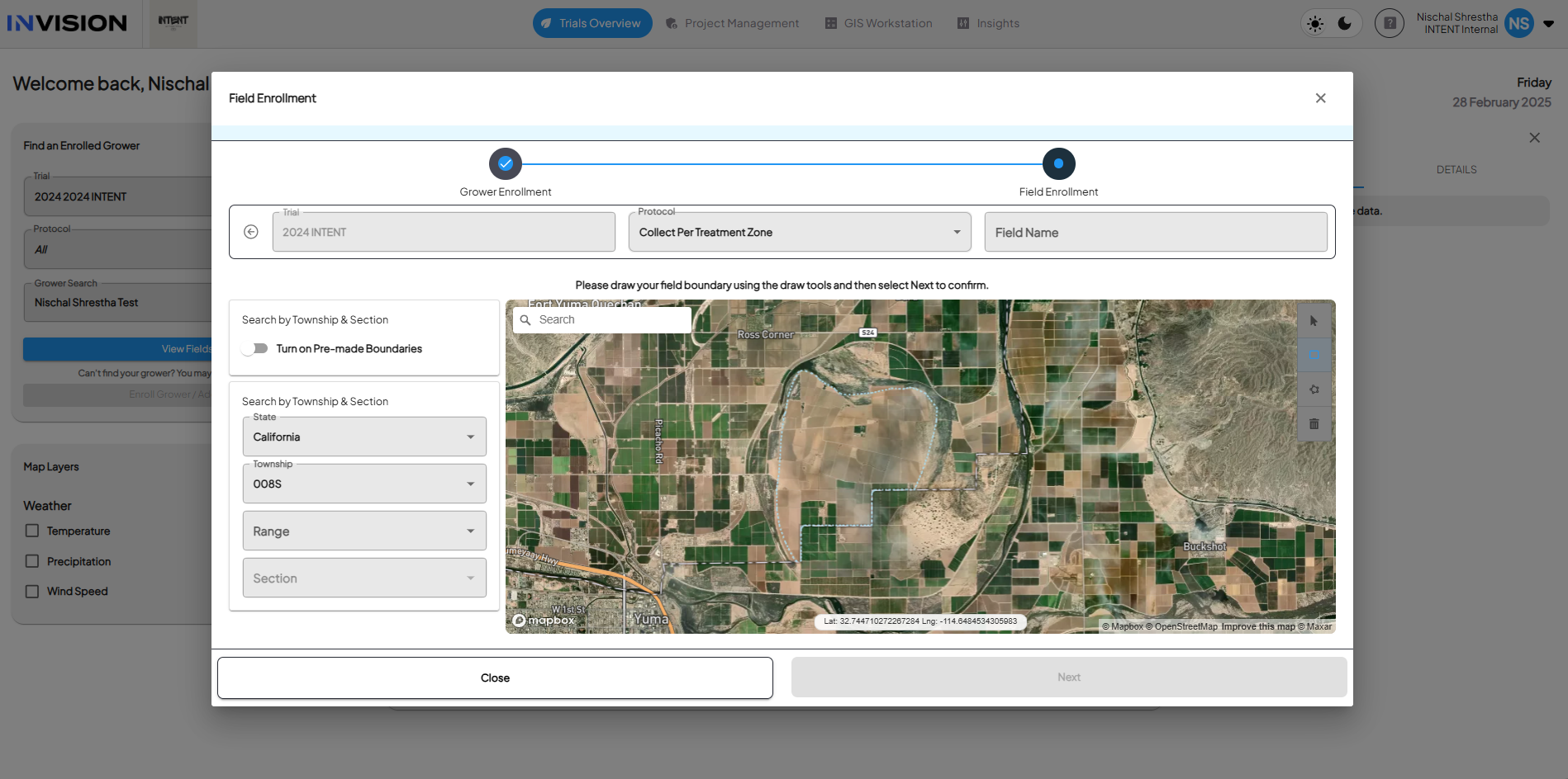
Township, Section & Range Enrollment: Users can now enroll fields using Township, Section, and Range in the U.S., with support for Canada coming soon.
-
Create Field Workflow: The enrollment process is now more intuitive with a new card-based design (upload file vs use map), simplifying the workflow.
-
-
GIS Workstation Enhancements
-
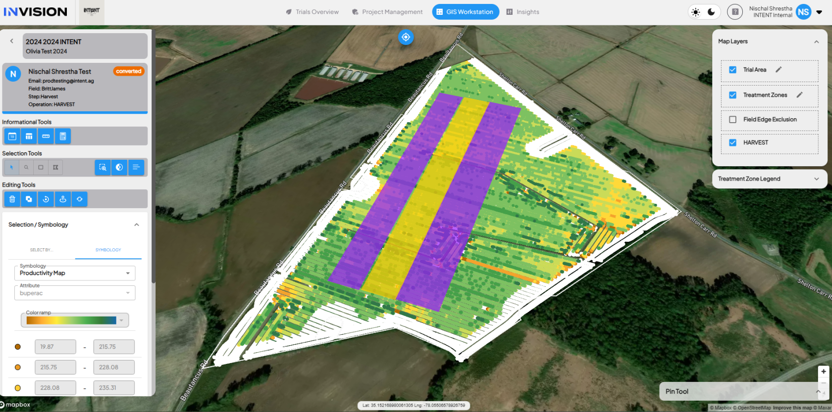
Yield Maps Preview: Users can preview both Productivity and Treated Yield Maps directly in the GIS Workstation while processing a harvest file.
-
Standardized Machine Data Sandbox (Staging Only): A sandbox environment for data conversion is now available in staging, allowing machine data standardization testing for future integrations.
-
New Trial-Processor Role: Introduced a new “trial-processor” role, granting access to GIS Workstation while limiting field access to relevant user roles. Trial-Operatives can now access the GIS Workstation with this role.
-
-
Covercress Growing Degree Days (GDD)
-
Covercress GDD calculations are now available in INVISION.
-

Bug Fixes
-
Favorited Imagery in PDF Results: The first four favorited imagery items (sorted by ascending date) are now included in PDF results.
-
GDD Discrepancy Fix: Resolved inconsistencies between Season at a Glance (Weather) and Imagery Timeline charts.
-
Soil Summary Chart Hover Issue: Fixed an issue where identical yield numbers appeared on hover in the Soil Summary Chart within View Fields.