September & October 2026 Release Notes v3.22.0
NVISION v3.22.0 introduces several new features and improvements across the platform, including elevation data for all fields, photo captions in INVISION Web and Mobile, and enhanced tools for harvest data cleaning in GIS Workstation.
This release also includes improvements to imagery analysis, reporting, mobile workflows, and overall platform reliability.
New Features
Elevation Layers – Now Available for All Fields
Elevation data is now available directly in INVISION, allowing users to explore field terrain and elevation changes without needing to upload their own elevation files.
INVISION automatically retrieves elevation data from publicly available sources based on the field's location:
-
USGS (United States Geological Survey): Elevation data for fields across the United States.
-
Natural Resources Canada (NRCan): High-resolution elevation data for Canadian fields where available.
-
Mapbox Terrain: Additional elevation coverage for fields where other sources are unavailable.
Users can visualize elevation differences across their fields to better understand terrain variability, identify potential drainage patterns, and consider elevation when planning trials or evaluating field performance.
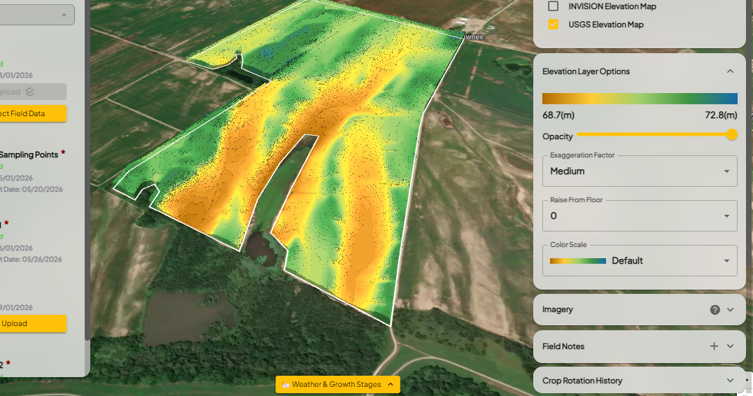
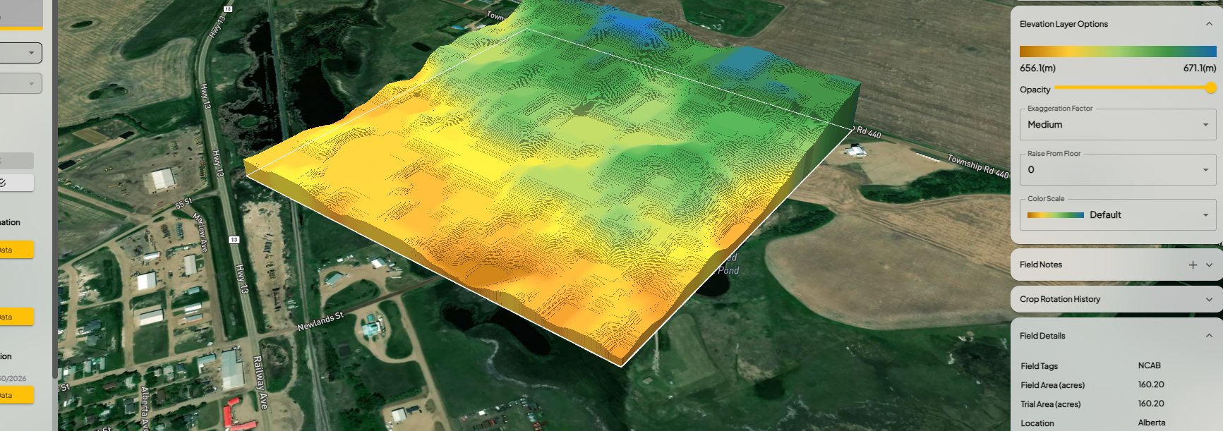
Elevation layers are automatically available for fields with defined boundaries, with resolution depending on the available data sources.
Photo Captions & Comments – INVISION Web & Mobile
Users can now add optional captions or comments to photos uploaded through INVISION Web and the Mobile App.
Whether documenting crop conditions, treatment responses, field observations, or trial progress, users can add a description directly to each photo.
Each caption remains associated with its corresponding image, making it easier to review field observations and understand the context behind photos throughout the season.
Feature Enhancements
GIS Workstation – Improved Selection Tools
We've made improvements to the polygon selection tools in GIS Workstation, particularly for reviewing and cleaning harvest datasets.
These updates improve how users select and work with specific areas of machine data, making it easier to identify observations that need attention, clean harvest results, and prepare datasets for analysis.
Harvest Results PDF – Improved Map Rendering
We've improved the performance and reliability of map rendering in Harvest Results PDF reports, particularly when working with larger harvest datasets.
These updates improve the generation of yield maps and address instances where Field Productivity and Treatment Area visuals were missing from generated reports.
Imagery & Time Series Analysis – Data Quality Improvements
Several improvements have been made to imagery analysis and Time Series Analysis to provide more reliable vegetation index results.
-
Cloud Coverage Filtering: Updated imagery filtering to better respect selected cloud coverage thresholds when calculating aggregated results.
-
NDVI & NDRE Analysis: Improved how cloud-contaminated imagery is handled to prevent invalid observations from affecting vegetation index trends and treatment comparisons.
-
Data Exports: Improved Time Series Analysis spreadsheet exports to address missing or incomplete results.
These updates provide more consistent imagery analysis and help users better interpret changes in crop conditions throughout the growing season.
Harvest Data Processing – Cotton Yield Improvements
Updated the automated harvest data cleaning process to better support cotton yield datasets that use pounds-per-acre (lb/ac) measurements.
This improvement ensures cotton yield units are handled appropriately during data processing and cleaning.
Additional Improvements
We've also made several smaller improvements across INVISION:
-
Trials Overview: Improved the Drought Map display and corrected filtering behavior in Project Progress.
-
INVISION Mobile: Improved the offline visit synchronization screen to display the associated field and protocol information.
-
Mobile Attachments: Updated attachment handling to prevent unnecessary location warning messages when removing photos or documents.
-
Performance Websites: Improved the default Seeding Date filter to remove the previous outdated start date.
These updates are part of our ongoing work to improve INVISION's field analysis, data processing, and reporting capabilities. We appreciate the continued feedback from our users and encourage you to keep sharing suggestions as we continue improving the platform.